Unusual dry season with heavy rain in the Nicoya Peninsula – Update from Montezuma and Karen Reserve in early January
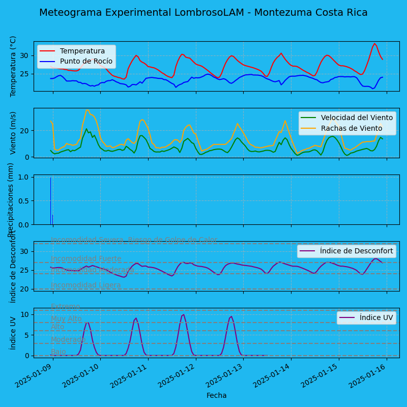
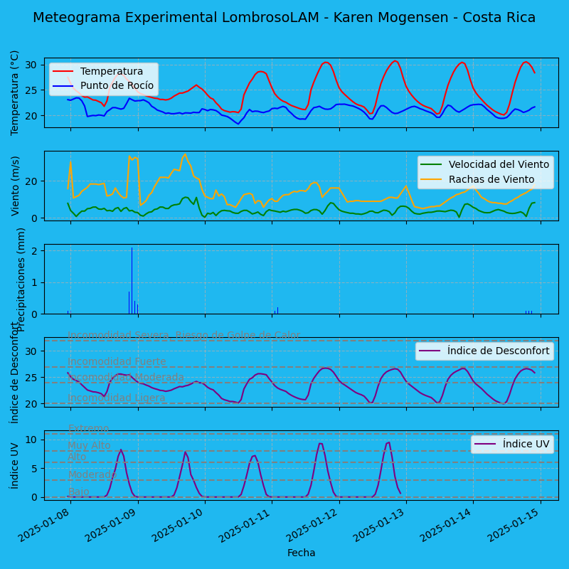
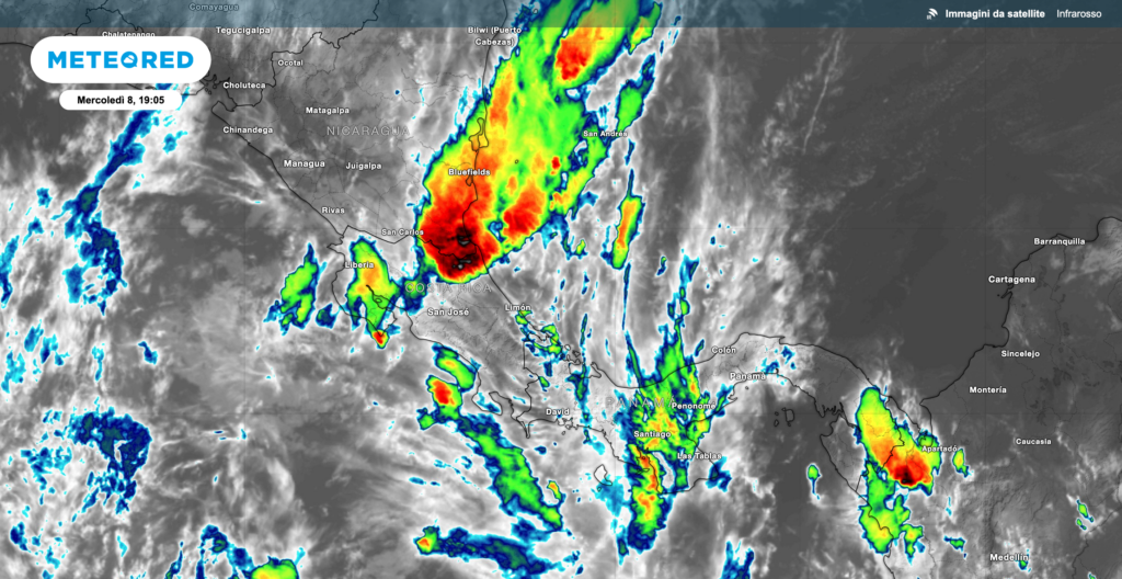
In recent days, the weather conditions in the Nicoya Peninsula have been quite unusual. After several mostly sunny days, we have returned to persistent rains, both in Montezuma, where I am currently located, and in the Karen Mogensen Reserve. These are not thunderstorms, but continuous precipitation reminiscent of the rainy season.
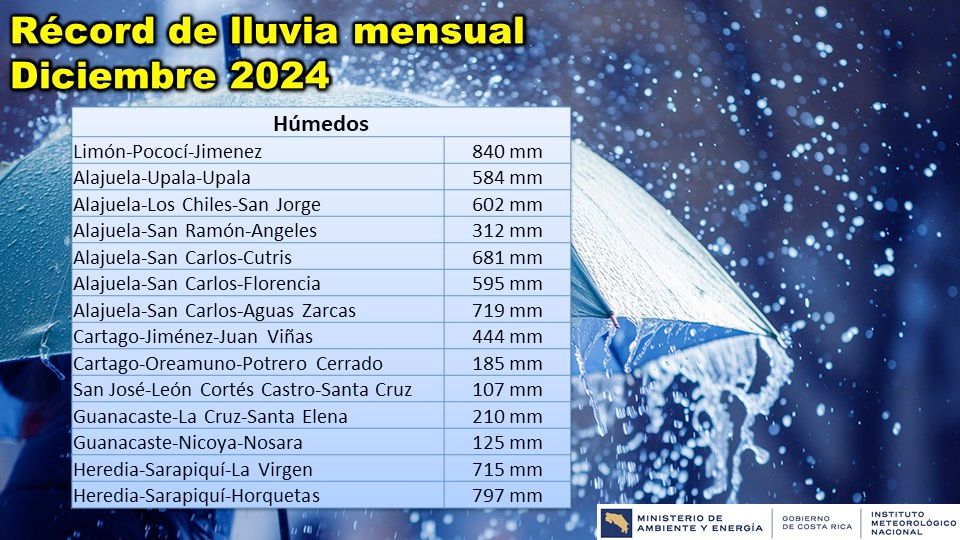
This situation represents a significant anomaly for the period. Although I do not yet have long-term observational data for a detailed analysis, ERA5 reanalysis data suggest that we may be facing record levels of rainfall for December. To confirm this, the Costa Rican National Meteorological Institute (IMN) reported that the past December recorded historic rainfall accumulations in several areas, including the Northern Zone, Guanacaste, and the Northern Caribbean. Their post reads: #IMN_Records The rainiest December. Last December recorded a significant number of rainfall accumulation records during the month. In several areas of the Northern Zone, Guanacaste, and the Northern Caribbean, historical accumulations were observed.
Restoration of the Weather Station at the Karen Mogensen Reserve
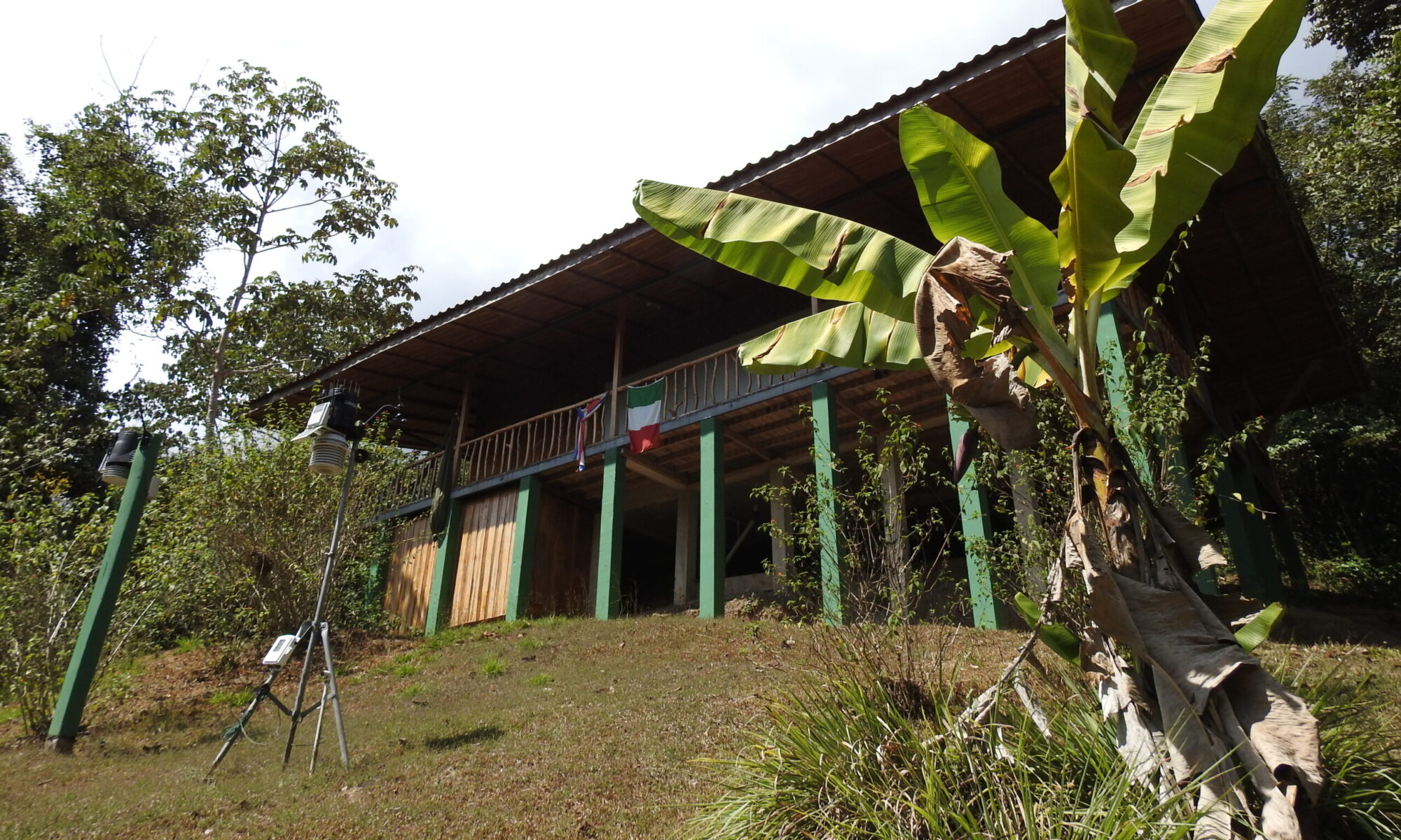
Thanks to the timely intervention of Dario Sonetti, our weather station at the Karen Mogensen Reserve has been functioning regularly for two days. This allows us to collect valuable data, pending the scheduled maintenance at the end of January. The data will be analyzed comprehensively to better understand this climatic anomaly.
Analysis of the Causes
Meteorologically, this anomaly appears to be linked to the unusually northern position of the ITCZ (Intertropical Convergence Zone), associated with weakened trade winds. We are currently in neutral ENSO conditions, with a 67% chance of briefly transitioning to La Niña, according to NOAA. However, this phenomenon alone does not explain the current situation. Additionally, the Pacific Ocean waters near the Nicoya Peninsula coast are warmer than usual.
Another element to consider could be the MJO cycle (Madden-Julian Oscillation), an atmospheric phenomenon that influences tropical rainfall patterns through the movement of active and inactive convection areas along the equator.
Climate Change and Future Outlook
Although it is difficult to directly attribute this anomaly to climate change, the global situation shows signs of increasing imbalance.
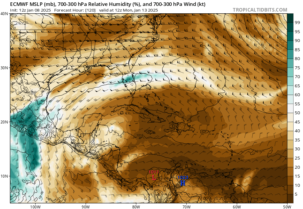
Looking ahead, weather models indicate a likely definitive return to the dry season. A cold front in the United States, while not directly impacting Costa Rica, will contribute to increased pressure in the Atlantic, strengthening the trade winds. The ITCZ should shift southward in the next 48-72 hours, finally bringing dry air, as shown by humidity maps between 700 and 300 hPa (4000-12000 meters).
Conclusions
We will continue to closely monitor the situation, collecting and analyzing data from our weather station to provide timely updates. Stay tuned for more news and analysis.
Best regards,
Luca Lombroso
